Saturday, May 28, 2011

From Norfolk, VA, to Cape May, NJ

The few days we spent in Norfolk attending the America's Great Loop Cruisers Association (AGLCA) Rendezvous were well worth the time and effort. Each day we attended very informative seminars regarding various legs of the journey still ahead of us, presented by knowledgeable cruisers who've "been there, done that."  As hoped, we also met many fellow "Loopers" who, like us, are currently on the their way. It was fun swapping stories and comparing notes and plans, plus seeing the variety of boat types and sizes other cruisers had chosen as their traveling home along the way.


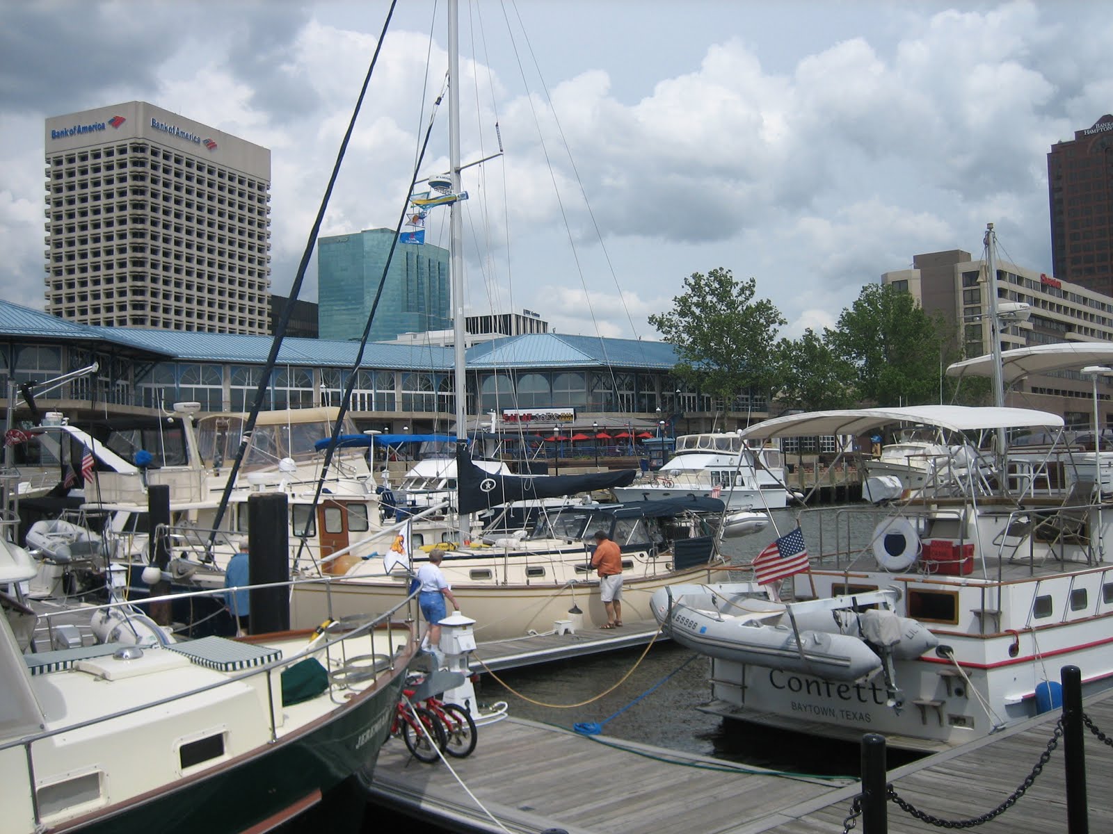
We were lucky they could accommodate us at Waterside Marina, which was perfectly located adjacent to the conference venue, plus lots of other Norfolk attractions. In fact, we were tied up right in front of the popular Waterside Festival Marketplace.


From our aft deck we could watch the paddlewheel ferry boat coming and going between Norfolk and Portsmouth across the river.


It was just a short walk to the Hampton Roads Naval Museum where we got up close and personal with the impressively huge Battleship Wisconsin.


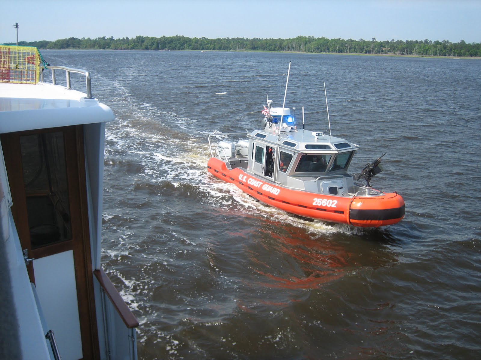
During our five day stay in Norfolk, as were were trying to absorb so many details of the enormous trip still ahead of us, one question kept nagging at us.  Where do we go from here?  The Chesapeake Bay, of course, but which stops along the way?  Do we do the western shore, the eastern shore, or a combination of both?  We finally decided to take it one step at a time and make decisions along the way.  On May 18th, as we left Norfolk behind, a bit anxious as to what lay ahead on the Chesapeake Bay, the weather was a bit iffy, cloudy with storms in the distance.


We encountered low swells at the Chesapeake entrance, with a breeze from the south.  At one point a beam sea had us rocking and rolling, but for the most part, our first day on the Chesapeake Bay was quite calm.  The hardest part was navigating between buoys, which were too far apart to see from one to the next, even though the major ones we were following were quite large.


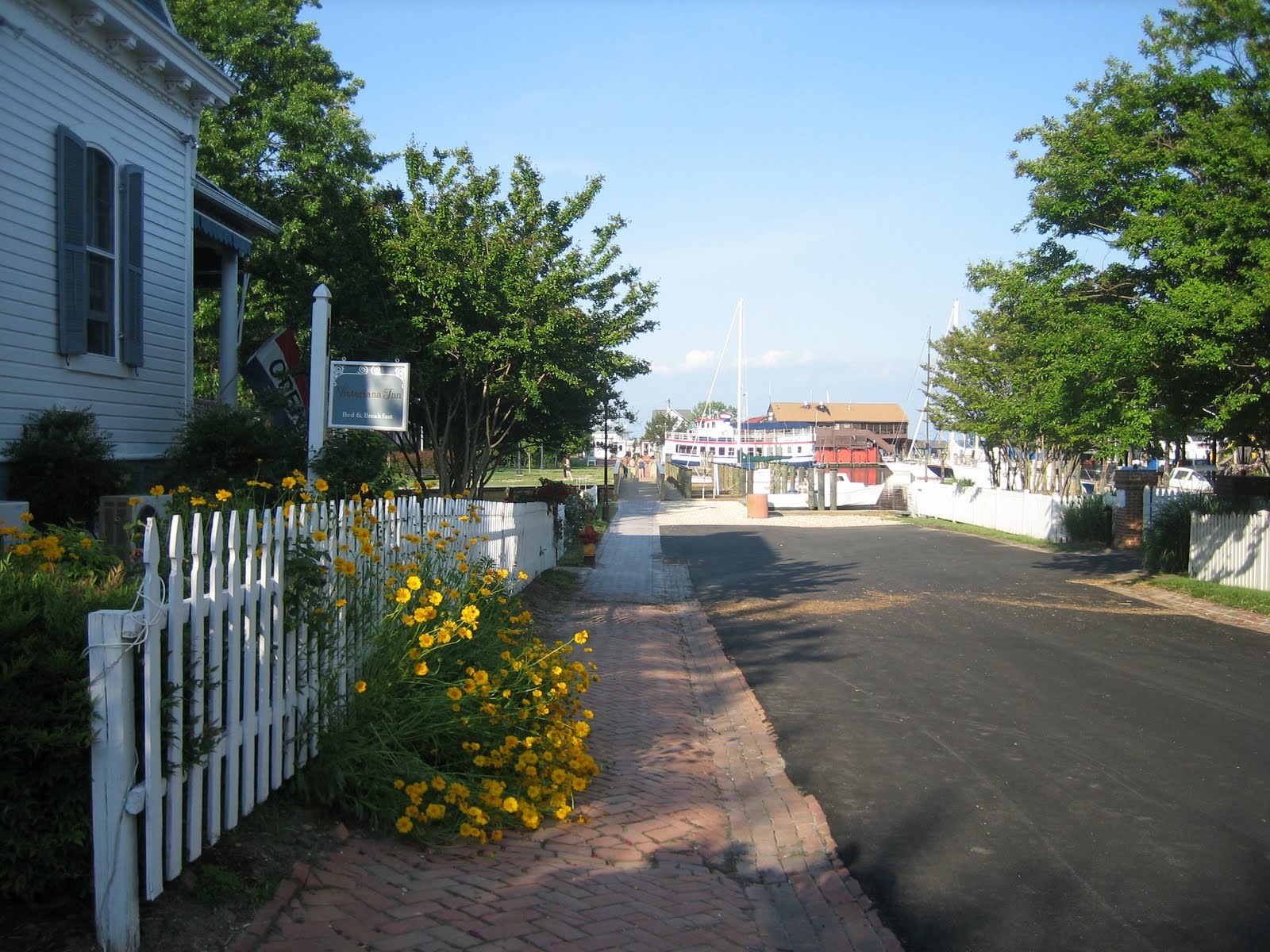
Our first stop was Deltaville, VA, and  Dozier's Regatta Point Yachting Center, located on Broad Creek, off the Rappahannock River. 


What a great choice that was, too. As AGLCA members we got a special dockage rate, and as an extra added bonus, those of us who had attended the Norfolk Rendezvous also got a third night at the marina free!  Little did we know until we arrived that they would also host a wine and cheese happy hour for us two of the three nights we were there, the first of which just happened to be my birthday.  What a treat!


If the weather had been warmer, we might have taken advantage of their swimming pool, but the water was a bit too cold for us wimps.


We did use their laundry facilities, plus their courtesy car (they have two) to go shopping for groceries and boat supplies.  The small town of Deltaville actually has two West Marine stores!  Our three days at Regatta Point gave us the time we needed to choose our next destination, Solomons, MD.

Once again, conditions on the Chesapeake were calm, which allowed us to concentrate on navigation, using both paper charts and GPS to locate the widely spaced marker buoys.


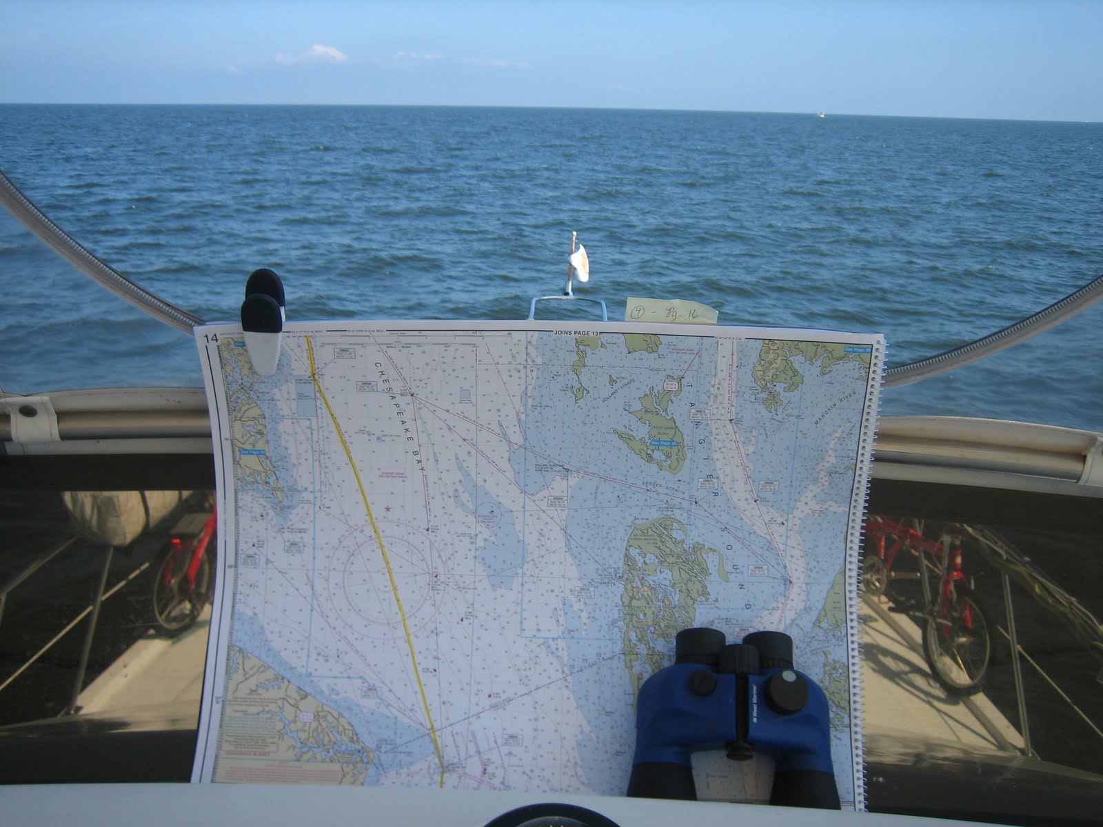
What a great reward when one would come into sight, and we knew we were on the right course.


Solomons, MD, is located near the mouth of the Patuxent River, on the Chesapeake's western shore.  We planned to anchor out our first night there and move to a marina for the next three days. The anchorage we chose was up Back Creek in a lovely setting.


However, after dropping the hook and shutting down the engines, we couldn't get our generator to start.  Luckily, our marina, Zahniser's Yachting Center, could take us a day earlier than planned, so up came the anchor again.


The main reason we had chosen Zahniser's was because they had a sail loft on site which could sew a ripped out zipper on one of our strataglass windows on the flying bridge.  They also had a full service boat yard with a mechanic who was able to get our generator problem sorted out.

The day we arrive turned out to be the opening day for their swimming pool and adjacent bar, and since the weather had turned hot and humid, we took advantage of it, even though the water was still pretty cold.


Solomons is a Mecca for boaters, with one marina after another lining the shores of its creeks. To fully appreciate this setting, we lowered our dinghy and went exploring.


As with any Chesapeake Bay area town worth its salt, one of the major attractions is a nautical museum.  But
the one in Solomons also has on site one of only three remaining screwpile lighthouses of the original 45 on the Bay.


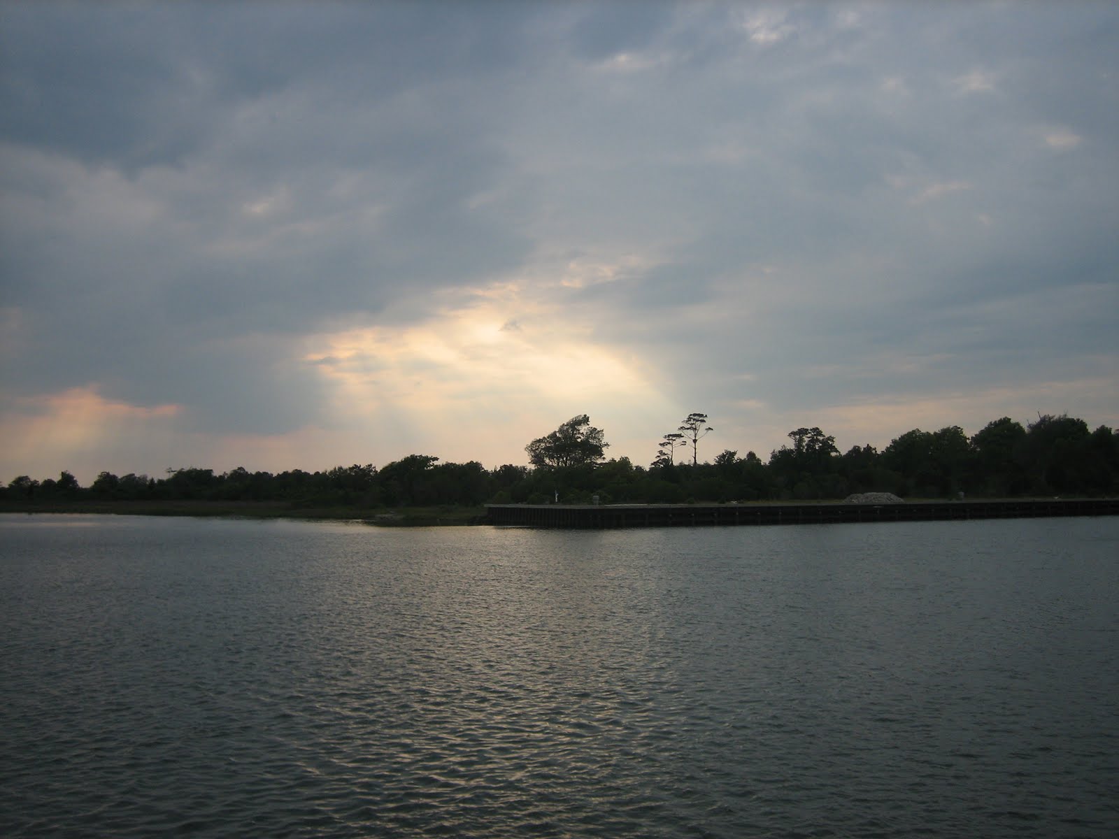
We had a lovely time at Solomons, with the only downside being the heatwave we encountered, plus accompanying swarms of bugs which made a mess of our boat.  At least they didn't bite!  As a parting gift, we received a beautiful sunset before leaving Solomons.


Next we decided to head over to the eastern shore to a place we had visited many years before by car (and loved), St. Michaels, MD.  Now the Bay was getting narrow enough for us to see from shore to shore, and some of those shorelines were quite interesting.


We also encountered some strange looking working boats, possibly oystermen?  Not sure, but they looked different than the numerous crabbers we had seen before.


At St. Michaels, we decided to try our luck again with anchoring and found a lovely spot in Fogg Cove, overlooking the famous Inn at Perry Cabin on one side,


and the back side of the Chesapeake Maritime Museum on the other.


This time the generator worked fine, and we sure needed it to keep our air conditioners going, because the heatwave continued during our stay in St. Michaels. We used our dinghy to go ashore, tying up at a dock provided by the town for that purpose.


This was conveniently located near the Maritime Museum and the Crab Claw Restaurant.


So we walked around town and had a delicious dinner of braised scallops and salad at the Town Dock Restaurant before heading back to our boat and the welcome relief of our air conditioned environment.  What a charming town.


The next morning, May 26th, we got an early start (6:40 a.m.), deciding to complete our trip up the Chesapeake, destination Chesapeake City located on the Chesapeake and Delaware (C & D) Canal.  It was sunny/hazy, and very hot and humid.  We had thought we might make one more stop on the eastern shore before bidding farewell to the Bay, but the forecast was for more of the same heat and humidity, so we were now looking forward to heading to Cape May, NJ, where it was a bit cooler.

The only things we saw of note before entering the canal were some creatures swimming in the water.  One looked like an alligator and a couple of others like otters.  Before we could try to snap pictures of them, they were gone, but they did get our attention anyway, and broke the boredom of our cruising day.

What a marvel the C & D Canal is.  It provides a means for vessels of all kinds to cut through from the Chesapeake area (including Baltimore and Washington, D.C.) to the Delaware River (and on to Philadelphia) without having to go hundreds of miles out of their way.  There is a dispatcher located at Chesapeake City, a few miles from the western end of the canal, who controls traffic through a system of red and green lights positioned at both ends.  Before entering the canal, one must check to see that the light is flashing green.  Since some huge ships regularly transit the canal, this can be very important. 

Also at Chesapeake City is a harbor where cruisers like ourselves can stopover either at a free dock (if there is enough room) or at an anchorage. It was still a grey day as we approached the entrance to this harbor.


As luck would have it, the dock was full, but there was plenty of room for us in the anchorage.  Our plan was to stay a second day to explore the town, but weather predictions changed our minds, and the next morning we pulled up anchor and made a run for it through the rest of the canal, down the Delaware River into Delaware Bay and the safe haven of Cape May, NJ.  Other boats left even before us.  Apparently, the word was out to make haste!


Upon exiting the C & D Canal and entering the Delaware River, we found good cruising conditions.  The tidal current was in our favor, which gave us a boost in speed, and the chop on the water was light. Once again, as on the Chesapeake, the channel markers were few and far between, some of them huge when we actually reached them.


As we progressed and the river broadened into Delaware Bay, the conditions changed dramatically.  First the light chop became a heavy chop with whitecaps.


Then the chop turned to waves (too rough to take pictures) increasing in size minute by minute.  We had to brace ourselves to keep from being knocked down as the Docker fought through the surf.  Actually, she handled it remarkably well, but both wind and waves kept pushing us off course, so we had to continually make course corrections to keep on heading toward the entrance to the Cape May Canal.  Finally, we made it, and all was calm again


This provided us with a false sense of security, however, because as we exited the canal and entered Cape May Harbor, the wind was whipping up a frenzy of whitecaps again.  This made for an interesting entrance to our marina, but we made it, finally ending up securely tied to a dock in a great Jersey Shore setting.


Now, we're looking forward to exploring Cape May, NJ over this Memorial Day weekend.

Saturday, May 14, 2011

From Bald Head Island to Norfolk

We stayed two days at Bald Head Island and just loved it. There is no bridge connecting it to the mainland, so the only way to get there is by boat, either a private boat like ours or the passenger ferry, which arrives every hour throughout the day.


There are no cars allowed on the island, so everyone travels around on electric golf carts.


The local grocery store, which also has a cafe attached, appears to be the place where locals meet to shop, have lunch, or just chat.


Bicycles are also a popular way to get around, which is how we toured the island.


The first stop we made on our bicycle tour was Old Baldy, North Carolina's oldest lighthouse, which is actually within walking distance of the harbor. I was anxious to check out the view from the top, but as luck would have it, the lighthouse was closed at that time. So, we just walked around, took some pictures, and enjoyed the view of Old Baldy itself from ground level.


The southern end of the island is rimmed with miles of beautiful pristine beaches, aptly named East Beach, West Beach, and South Beach.  Although the ocean temperature was too cold for us to go swimming, we did enjoy a nice walk along the East Beach before continuing our bicycle journey.


We saw some pretty impressive homes along this stretch of beach, nestled in behind the sand dunes.


The south end of the island is where the homes, nice beaches, and golf courses are located, but a huge part of the island is covered with marshes and creeks which can be explored by kayak.


The harbor where we docked our boat, which is also where the ferry comes in, is a beautiful community itself, with private homes, bed and breakfast inns, and a wharfside restaurant.


We were reluctant to leave, and almost stayed on for another day, but we knew that the clock was ticking and we needed to move on if we wanted to get to Norfolk for the America's Great Loop Cruisers Association (AGLCA) Rendezvous, which would begin on May 14th. So, on Sunday, May 8th we left Bald Head Island and headed up the Cape Fear River, past Southport, NC and toward Snows Cut, a canal which would take us to Myrtle Grove Sound toward Wrightsville Beach and beyond.  Shortly after entering the Cape Fear River, however, a Coast Guard boat hailed us, wanting to board and conduct a safety inspection.  Well, since you don't say no to the Coast Guard, we said, "Welcome aboard!"


Although we passed the inspection with flying colors, we were distracted from our navigation while they were on board asking questions and checking our documents, etc., so much so that we missed our turn off for Snows Cut.  It wasn't until after we bid them a fond farewell that we realized we were way up the Cape Fear River and would have to turn around and retrace our route, losing an hour of time and wasting fuel.


Oh, well, it's only money (argh!). After that, we just chugged along and enjoyed the scenery, checking out our various options for an anchorage that night. We decided that Wrightsville Beach was too close for a stopover, so we continued on.  We had two other options, either Topsail Beach or Mile Hammock Bay at Camp Lejeune.  One determining factor was the timing of the bridge opening at Surf City (just north of Topsail Beach) which happens every hour on the hour.  We just missed one opening, and didn't want to wait for another hour, so we headed for the Topsail anchorage.  After dropping the hook in a couple of spots, we finally decided that the best spot was already taken, so we pulled it up and raced on to make the next Surf City Bridge opening just in the nick of time.  Finally, at 6:00 p.m., we very thankfully secured our anchor at Mile Hammock Bay as guests of the Marine Corps.  It's actually a lovely spot, with plenty of room for several boats.


The next morning we descovered the only negative feature of that anchorage, very thick mud which mucks up your anchor and chain and is very difficult to wash off while raising the anchor.

Our next destination was Oriental, NC, which we had heard was a great place and very cruiser friendly.  We were torn between a marina in downtown Oriental or another one eight miles north of the area where most cruisers go.  We opted for the northernmost marina, at River Dunes on Broad Creek, off the Neuse River.  This turned out to be a good decision for us for a couple of reasons.  First of all, it's a lovely place, and second, they were offering dockage for just $1.00 per foot, which is cheap. 

While we were traversing the Neuse River, which is quite impressive sizewise, we lost control of the throttle on our port engine.  Although this caught us by surprise, by this time in our cruising experience we had traveled on one engine several times already, so we knew we would have no problem reaching our destination for the night and docking at the marina.  In fact, I was still able to use both engines at idle speed, so we followed our normal procedure when entering the marina channel and pulling in to the dock. The marina staff contacted a mechanic, who arrived early the next morning, fixed the problem in a matter of minutes (loose cable connecting lower helm controls to upper helm controls) for a total cost of $68, and we were on our way, right on schedule.

Lucky for us, the weather conditions had been very favorable for cruising, and the forecast was for more of the same, since we were going to be crossing some more large bodies of water which can be treacherous when wind and current are at odds with each other. Neither the Neuse River nor Pamlicao River presented any problems, and we arrived without incident at our anchorage on the Pungo River, a little bit north of Belhaven, NC.

Wednesday, May 11th, just one week after our departure from Charleston, was probably our most interesting, but eerie, cruising day so far.  At 7:10 a.m., we pulled up anchor (muddy again) and then entered the  twenty mile long Alligator River-Pungo River Canal. At this point we were heading due east, right into the morning sun, which made it rather difficult to see ahead without being blinded by the sun's light reflecting off the water. The shores of the canal were lined with cypress trees, with exposed stumps extending out into the channel, along with various bits of debris, including tree branches.


Once again, as we had seen on the Wacamaw River in South Carolina, the water was brown with tannin.


Forest fires were burning out of control in surrounding areas, which made for smokey air and very poor visibility for several miles along this route.


In fact, we were almost upon the Highway 94 bridge before we could see it.  Here it is barely visible ahead of us.


In a different section of the canal which had grassy shores and no smoke, we saw a black bear and three wild turkeys, but those sightings occured so quickly that we were not able to get pictures of them.

This canal finally deposited us in the Alligator River where we encountered a north wind and moderate chop for the next twenty miles.  We could have continued on to the mouth of the river and on across Albermarle Sound, but both the wind and chop were picking up, so we decided to stop overnight at the Alligator River Marina and save the Albermarle Sound crossing for the next morning when conditions would probably be more favorable.


That turned out to be a very good decision.  Light chop turned to moderate chop as we entered Albermarle Sound at the break of day with a light NE breeze and favorable current, allowing us to make the fifteen mile crossing without any weather worries.


Our only problem turned out to be dodging crab traps all along the route, most of which we couldn't see until we were practically on top of them.  Then, to add insult to injury, as we entered the North River after crossing the Sound, a crabber brazenly darted across the channel in front of us while tending his traps.


Oh, well, if you can't beat 'em, join 'em! Upon arrival at the Coinjock Marina, we both feasted on crab for lunch.  Mine was a delicious soft shell crab sandwich, with the legs sticking out on each side of the bun. Yum!


Docking at the marina was very easy, just pulling up to the bulkhead with a starboard side tie up. First we fueled up, and then pulled up behind the only other boat there, a large sport fisherman.


About three hours later, other boats began to arrive, and by the end of the day, the entire 1200 ft. long dock was full, with the exception of a small space left open for fueling purposes.  In fact, we were so squeezed in that our bowsprit was hanging over the transom of the aforementioned sport fisherman, and the Kady Krogen ("Avalon") that pulled in behind us was almost touching the dinghy that hangs off our stern, which would make for a challenging departure the next morning.

We were anxious to get an early start, so by 6:30 a.m. we were ready to go, just chomping at the bit, standing on the dock with the folks from Avalon and other boats, discussing our options. Captain Mike suggested that we release our stern line, keeping the bow line tight to the dock, then thrust out the stern into the oncoming current, which would catch the stern and push it out further into the channel, thus moving away from Avalon, at which point he would release the bow line, and we could put the engines in reverse and back out into the channel.  It worked like a charm.  Thank's, Mike.

This was the last leg of our cruise to Norfolk, where we planned to stay from May 13th through the 17th, attending the AGLCA Rendezvous, but we were not there yet.  We still had many bridge openings, plus our very first lock to contend with before our cruising day would end at Norfolk.  We tried to time our arrival at each bridge near their scheduled opening time, but it was impossible to avoid some wait time before.


Then, finally, we would be rewarded for our patience with a welcome sight ahead of us.


Of course, we had dealt with bridges many times before, just not so many of them in one day.  However, we had never been through a lock, so we were nervous contemplating our first time as newbies.  Would we disgrace ourselves in front of the lock keepers and other cruisers?  Captain Mike, from Avalon, who had helped us with our departure from Coinjock, had gone through the Great Bridge Lock many times before, so we discussed the procedure with him to help us get prepared.  Following his advice, plus the instructions from the lock master upon our arrival, we entered the lock and tied up with no real difficulty. 


First, I pulled the boat over to the lock wall, allowing Ken to loop the bow line around a cleat on the wall.  Then I shifted both engines into neutral and ran down from the helm station to loop the stern line around another cleat.  Then we just held on to both lines, keeping the boat in place until another boat entered the lock and struggled to gain control.  They only had one engine, which makes this operation more difficult.  Anyway, they finally got tied up, and there were no other boats waiting, so the gates closed and the lock did its work.  When the gates in front of us opened, we asked permission to leave, and that was it.  No big deal.
We know that some of the other locks we will encounter on our trip will be much more challenging, but at least now we have successfully negotiated our first one.

The few miles remaining to Norfolk were ugly industrial as we traveled along the Southern Branch of the Elizabeth River, and to make it worse, it was very cloudy.


But then, all of a sudden we were there, approaching the Waterside Marina, where the Southern Branch and the Eastern Branch of the Elizabeth River converge.  The entrance to the marina is off the bow of the tripple masted schooner pictured below.


We were instructed to delay entering the marina while another boat docked, which gave me a chance to take a few pictures of the area adjacent to it.


Then, it was our turn to enter the marina and pull up to our dock space.


So, here we are, 1,105 miles north of where we began this northern migration in early March. We are looking forward to an informative and enjoyable few days, meeting fellow "Loopers" and gleaning helpful information about our route ahead.